[Science Through Covers] Google DeepMind AI boosts 15-day tropical cyclone forecasts - DongA Science
High confidence: full text extraction produced 3135 characters.
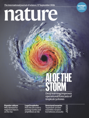
This week’s cover of the international journal Nature features an analysis of a spiraling tropical cyclone. Tropical cyclones—known by various names such as typhoons and hurricanes—can cause enormous loss of life and property depending on their characteristics, yet they remain very challenging to forecast.
An international collaboration led by Google DeepMind in the UK has developed an artificial intelligence (AI) weather model called “WeatherNext Cyclone (WN-C)” that simultaneously predicts the track, size and intensity of tropical cyclones. The team published their results in Nature on 6 August (local time).
WN-C is trained on several decades of global atmospheric reanalysis data from the European Centre for Medium-Range Weather Forecasts (ECMWF), together with a dataset containing about 5,000 tropical cyclones. Based on this, it probabilistically generates more than 50 possible typhoon and weather scenarios up to 15 days ahead.
When the team evaluated performance using tropical cyclones from 2023–2025, WN-C secured, on average, more than one extra day of forecast lead time over major operational models for track, maximum wind speed and the radius of gale-force winds. The mean track error at five days was about 230 km, which is 140 km smaller than the 370 km of ECMWF’s ensemble forecasts, and WN-C reached a given level of accuracy roughly 30 hours earlier.
For three-day maximum wind speed forecasts, WN-C was on average 3.75 knots more accurate than the U.S. National Oceanic and Atmospheric Administration (NOAA) high-resolution, hurricane-specialized model HAFS. This improvement is comparable to what traditional numerical weather prediction systems typically achieve over about a decade.
Notably, contrary to the prevailing view that high spatial resolution is essential for predicting cyclone intensity, WN-C uses relatively low-resolution global atmospheric data on a grid of about 0.25 degrees, yet still delivers higher intensity prediction skill than high-resolution regional models.
For forecasts of “rapid intensification,” defined as a 30-knot or greater increase in maximum winds within 24 hours, WN-C also improved the balance between detection and false alarms compared with existing operational models. When run as a large ensemble of 1,000 members, it captured low-probability risks of extreme winds more effectively.
When WN-C was added to the existing consensus forecasts of the U.S. National Hurricane Center (NHC), average track errors decreased by an additional 28% and intensity errors by an additional 6%. A current limitation is that the model does not directly predict rainfall, storm surge, or localized gusts associated with typhoons, and it depends on high-quality initial atmospheric analyses.
The research team noted, “We have been providing trial predictions to NHC forecasters since the 2025 Atlantic hurricane season,” and explained, “AI is most valuable not when it completely replaces traditional numerical weather prediction, but when it is combined as an additional source of guidance with different error characteristics.”
<Reference>
- doi.org/10.1038/s41586-026-10953-2